
A cold front heading to the Ozarks will offer a chance of some minor snow accumulations and significantly lower temperatures.
National Weather Service forecasters say snow flurries will be the most likely precipitation with accumulations likely north of the Lakes Region tonight into Thursday morning. Meantime temperatures, which has just rebounded after the weekend cold front, will again drop and strong north winds could see wind chill readings dip below zero.
High's Thursday will only reach the upper 20's with low temperatures in the teens.
Another storm system will move through the Lakes Region Saturday. Some area may see some freezing rain early but most areas will see just rain as temperatures will be above freezing most of the day.
 CMN Radiothon Year 3 Results in Around $82,000 in Donations
 CMN Radiothon Day 2
 When Will the Next Chance of Rain Arrive?
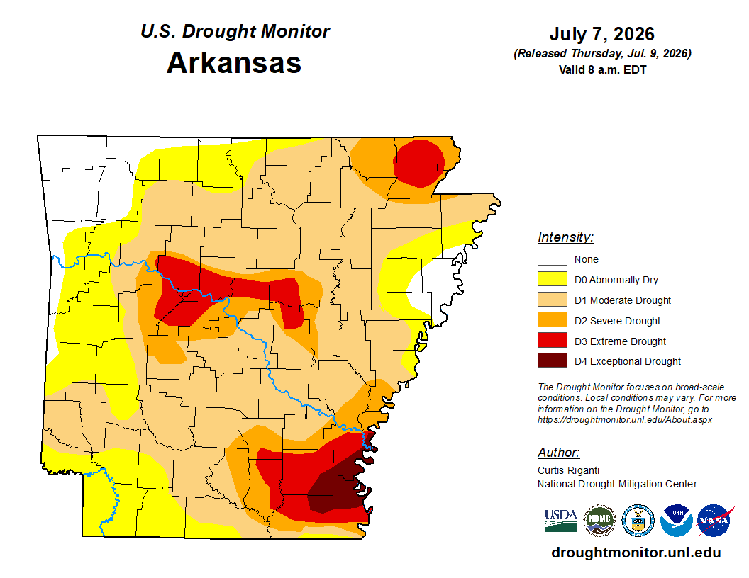 Drought Area Continues to Dwindle
 Stone County Crash Injures Three People