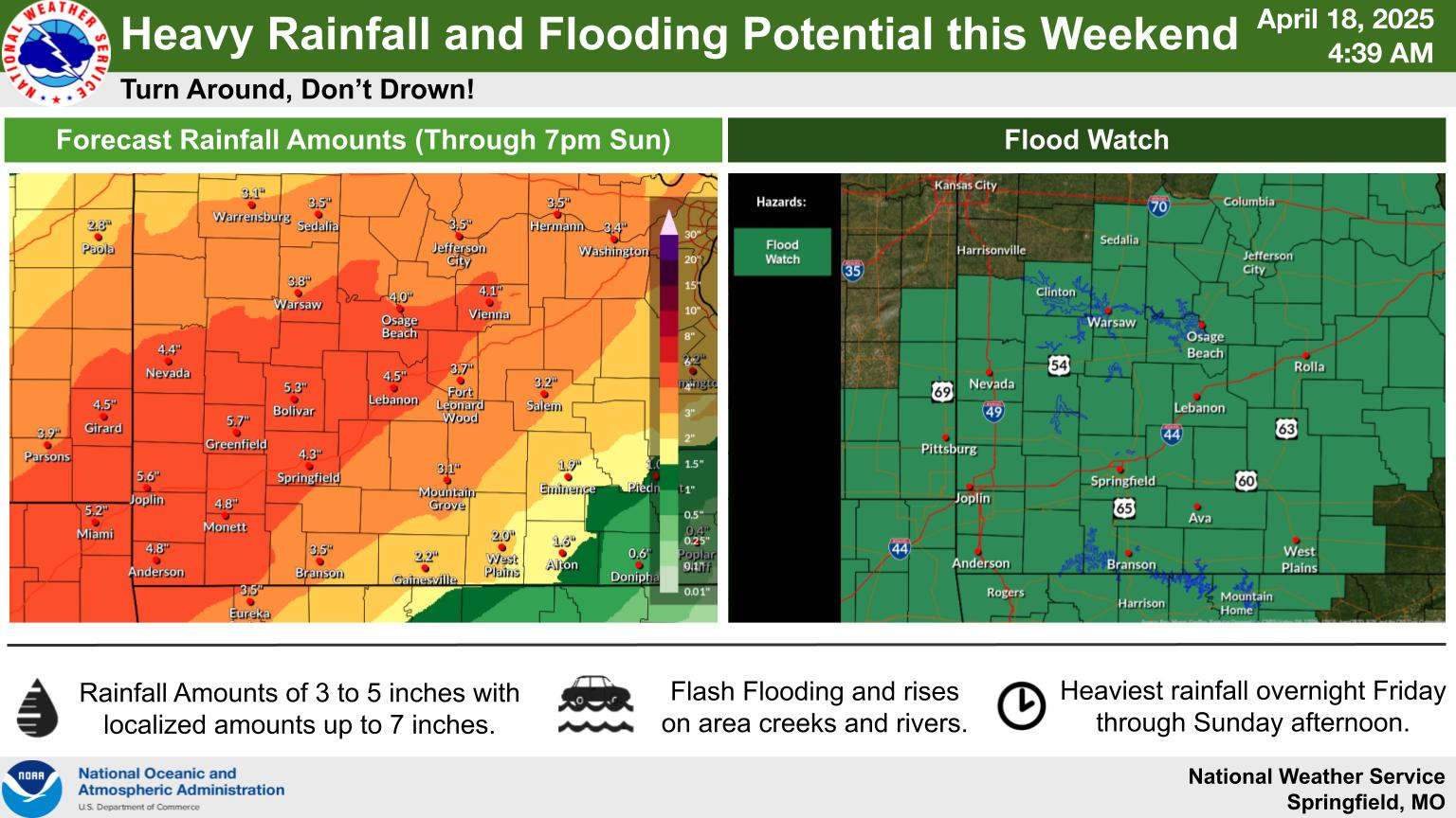
The National Weather Service has issued a Flood Watch for the Lakes Region beginning tonight and running through Sunday.
Rounds of showers and thunderstorms are expected to occur during the Easter Weekend accompanied by a slight risk of severe weather each day. Hail and damaging winds are the biggest threats with the storms.
Rainfall projections are for around three and a half inches on a line between Branson and Eureka Springs with higher amounts northwest of that with slightly less amounts southeast of the line including the Harrison area.
 Breaking News: Dolly Parton Dies at 80
 Efforts Underway to Help Family Involved in Crash
 Man Facing Taney County Murder Charges Now Charged in Boone County
 Back to School Part Two: Missouri Schools Return to Class
 National Labor Day DWI Mobilization Under Way