
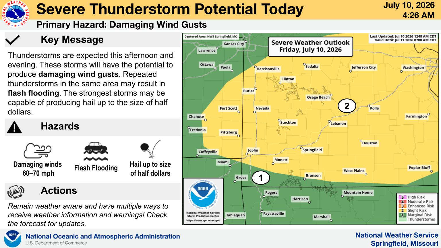
National Weather Service Forecasters say that severe weather is a possibility for late tonight into early Wednesday morning.
The latest information leads forecasters to predict the strongest storms will impact the Lakes Region with large hail and strong wind the primary threats. Some isolated tornados are also possible. Rain will clear out during the day Wednesday.
After the potential for record highs in the 80s today, temperatures will fall to the 50s on Wednesday before warming back up to the 70s by the weekend.
 CMN Radiothon Year 3 Results in Around $82,000 in Donations
 CMN Radiothon Day 2
 When Will the Next Chance of Rain Arrive?
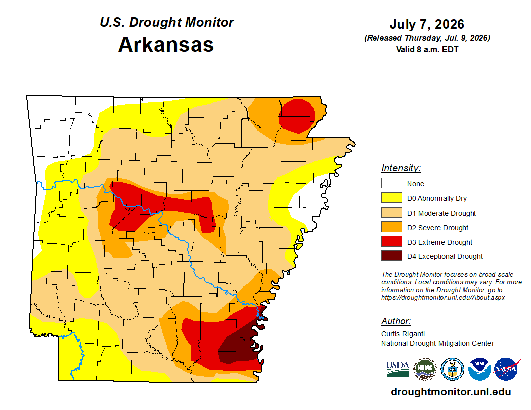 Drought Area Continues to Dwindle
 Stone County Crash Injures Three People