


After a warm-up over the weekend that melted much of the snow that fell in the Lakes Region Thursday and Friday, the week begins with a cold blast.
A front moving through late Sunday night brought temperatures down to the teens and lower 20s overnight will only allow temperatures to warm just above freezing today. Some area roads and sidewalks will have slick spots due to the refreezing of the melted snow.
Temperatures rebound back to the 40s by Tuesday and could see some 50-degree temperatures by Thursday before another front brings another chance of precipitation and colder air late Friday.


 C of O Women Claim Another National Championship, Men Win to Close Out Shepherd Tenure
 Final Input for Stone County Planning and Zoning Coming This Week
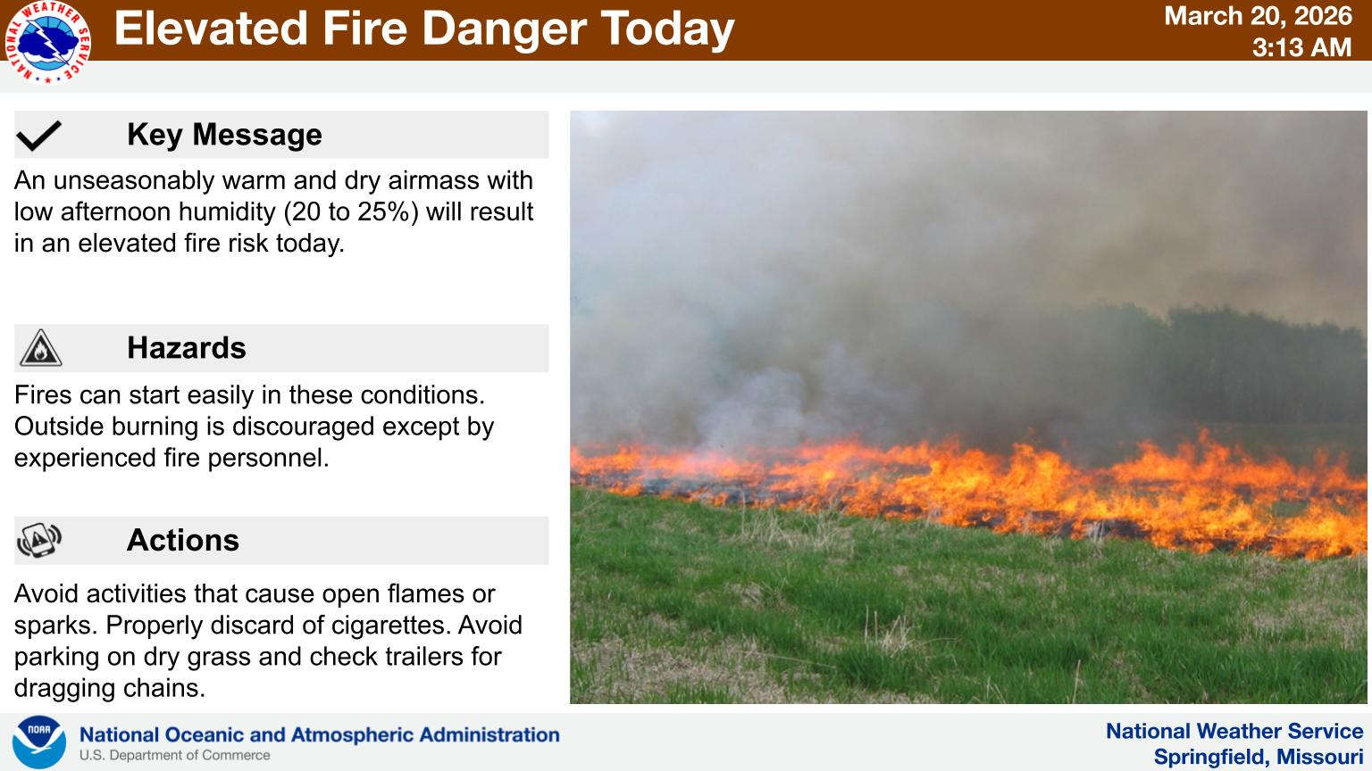 First Day of Spring Feels Like Summer with Fire Risk
 Homicide Investigation in Carroll County
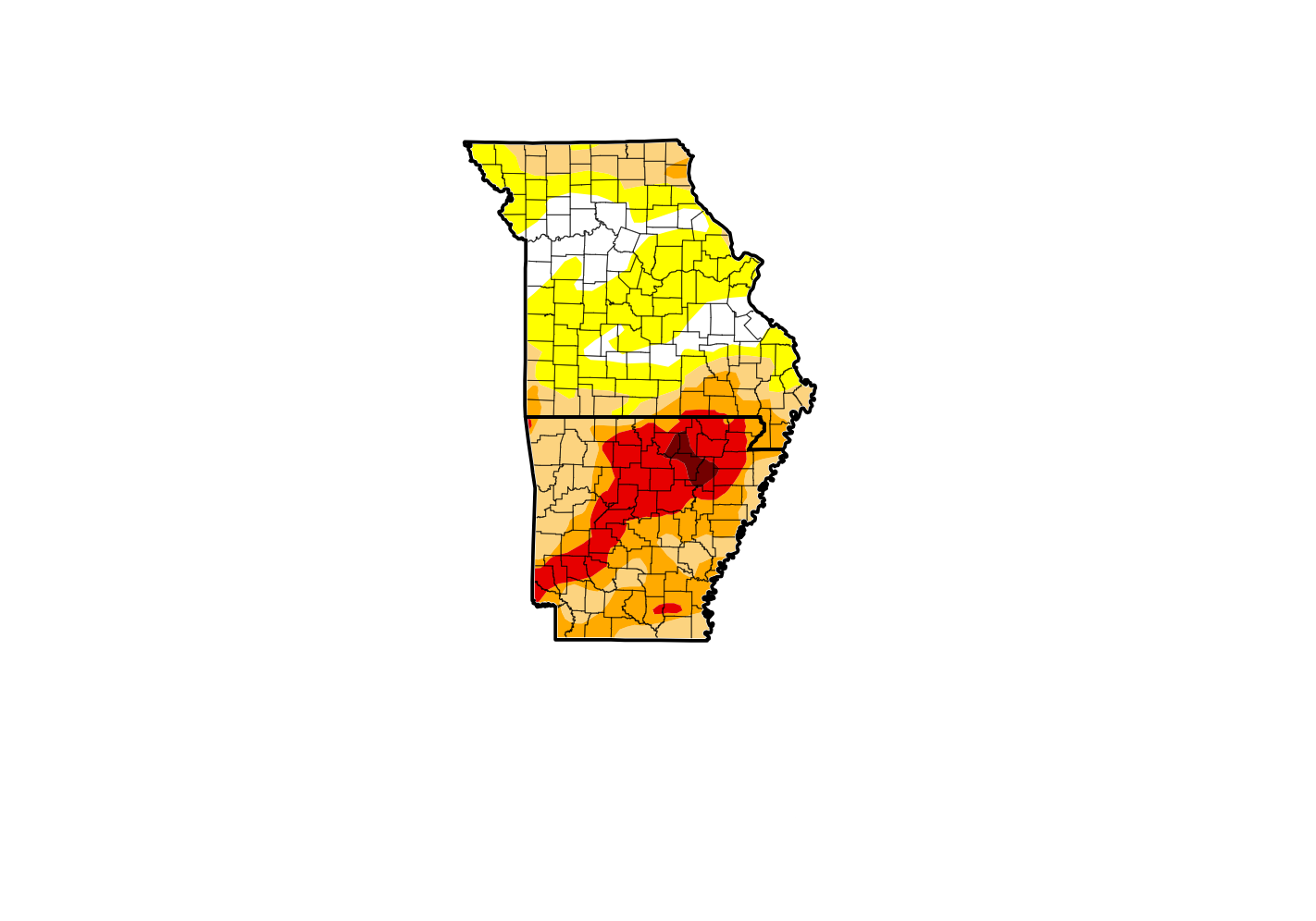 Recent Precipitation Holds Drought Steady