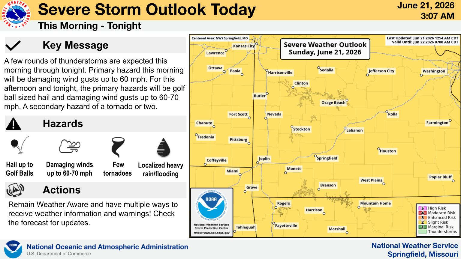
UPDATE SUNDAY 6:15: The National Weather Service has issues a Severe Thunderstorm Watch for the Missouri Ozarks as well as the border counties in Arkansas until 1:00 am Monday. The Watch does include both the Branson and Harrison areas with Lakes Region counties in the watch area including Barry, Stone, Taney, and Ozark Counties in Missouri along with Carroll, Boone, and Marion Counties in Arkansas.
Original story:
The Lakes Region is still on track to receive heavy rain today with a Slight Risk of severe storms.
The latest update from the National Weather Service says an initial round of showers will move through this morning but most of the rain will stay north of the Lakes Region.
The second round will take place tonight into early Monday morning which will move through Lakes Region with the potential of hail and damaging winds. Heavy Rain will be possible with the second round of rain with a widespread one to three inches rain possible with localized higher amounts possible.
A Flood Watch is in effect until early Monday morning for the Missouri Ozarks.
 Two Dead, Three Injured in Head On Collision in Hollister UPDATE
 Trail Set for Man Charged in March Death of Man at Bee Creek Apartments
 Therapy Dog Continues to be Part of Blue Eye School District
 Mexican Cartel Member Arrested in Lakes Region
 Crane Broiler Festival Underway, Continues Today