
While there is still some uncertainty with the timing of the system, forecasters are predicting a minimum impact with winter weather moving through the Lakes Region Sunday night into Monday.
The current trends predicted by the National Weather Service shows a limited to minor impact as rain changes over to snow during the overnight hours. Lakes Region temperatures are expected to be at or just above freezing limited the chance of accumulating snow to no more than one inch. Parts of northern Stone and Barry Counties could see higher amounts according to the current forecast trend while the heaviest impact currently forecast for areas around Springfield and to the east, where four plus inches of snow could occur.
While travel impacts are possible on Monday, the precipitation will go back to rain before ending in the afternoon with temperatures expected to rebound into the 50's on Tuesday.
 CMN Radiothon Year 3 Results in Around $82,000 in Donations
 CMN Radiothon Day 2
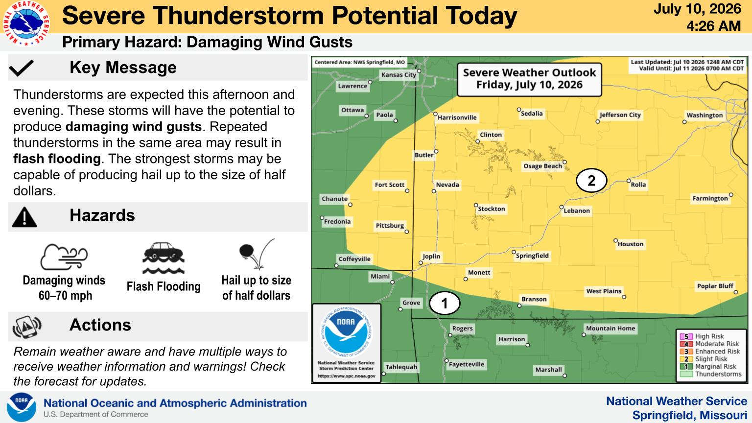 When Will the Next Chance of Rain Arrive?
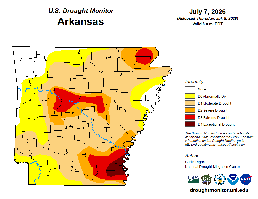 Drought Area Continues to Dwindle
 Stone County Crash Injures Three People