UPDATE 2 4:00 pm: A Tornado Watch is in effect for Stone County in Missouri and Carroll County in Arkansas and areas to the west. Strong to severe storms expected in the Lakes Region
UPDATE: The National Weather Service has raised the Severe Weather Risk to Moderate throughout the Lakes Region. Forecasters expect thunderstorm chances to begin early to mid-afternoon and continue through this evening.
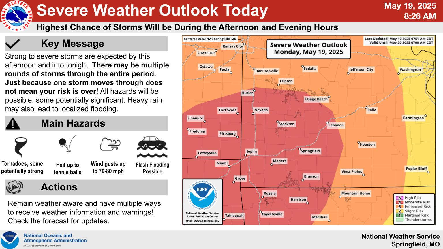
The National Weather Service continues to predict the potential for a severe weather outbreak today.
The risk for most of the Lakes Region today is at a Level 3 of 5 or Enhanced Risk though areas of far southwest Missouri and northwest Arkansas are at a Level 4 or Moderate Risk. All modes of severe weather are possible including hail, damaging winds, and possible tornados.
Heavy rain is also a risk with the round of storms expected through this evening with Flood Watches in effect for the entire evening.
Rain will end during the day on Tuesday with cooler, more seasonal temperatures in place for the rest of the week.
 CMN Radiothon Year 3 Results in Around $82,000 in Donations
 CMN Radiothon Day 2
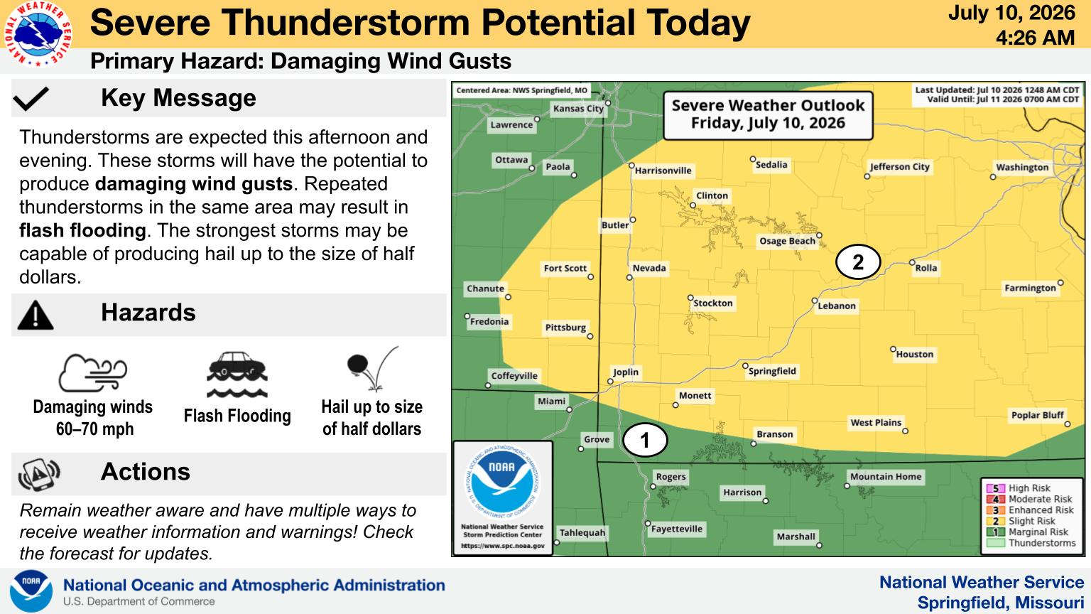 When Will the Next Chance of Rain Arrive?
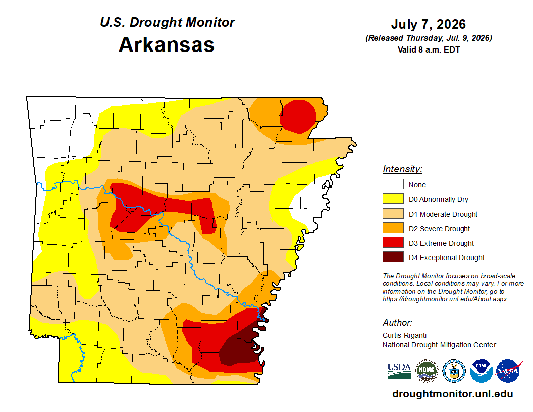 Drought Area Continues to Dwindle
 Stone County Crash Injures Three People