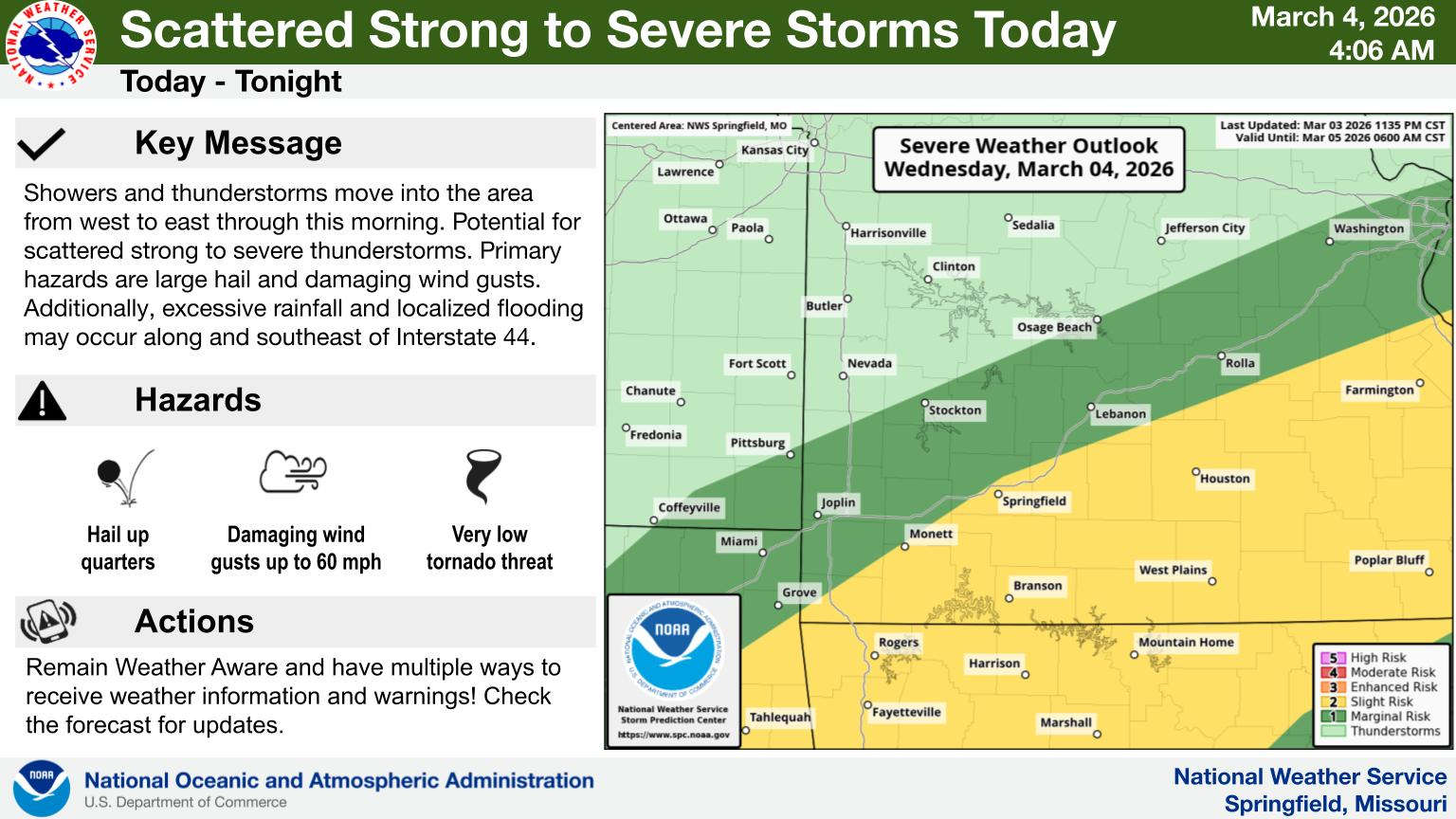
The area of possible severe weather continues to expand in the Ozarks.
The Lakes Region is still at a Slight Risk of severe storms today, though the area of possible storms has expanded to most areas south and east of Interstate 44. Hail up to quarter size and strong winds are the main threats though an isolated tornado is also possible. Heavy rain will accompany some of the stronger storms.
A round of severe weather is possible this morning, but the greater chance of severe thunderstorms is this afternoon and evening.
National Weather Service forecasters also expect a Sight to Enhanced Risk of Severe Thunderstorms on Friday.
 CMN Radiothon Year 3 Results in Around $82,000 in Donations
 CMN Radiothon Day 2
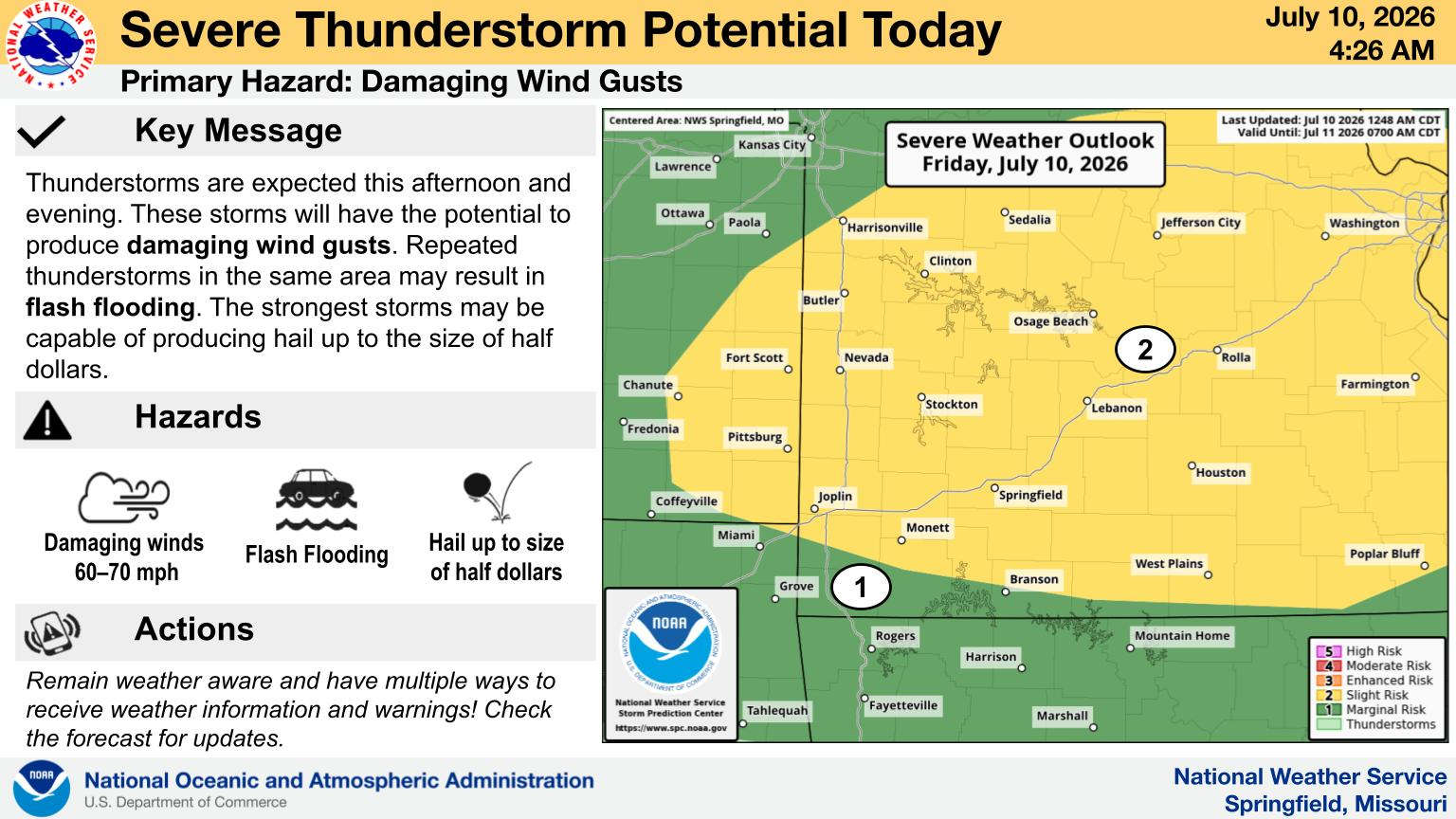 When Will the Next Chance of Rain Arrive?
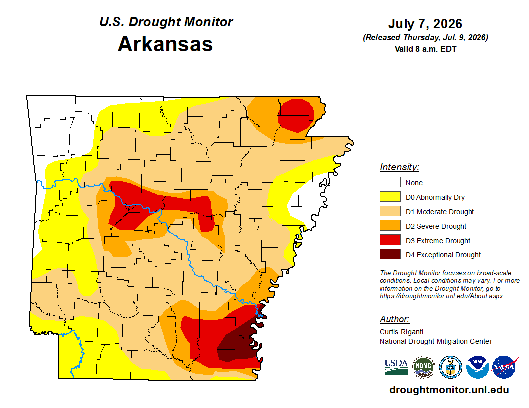 Drought Area Continues to Dwindle
 Stone County Crash Injures Three People