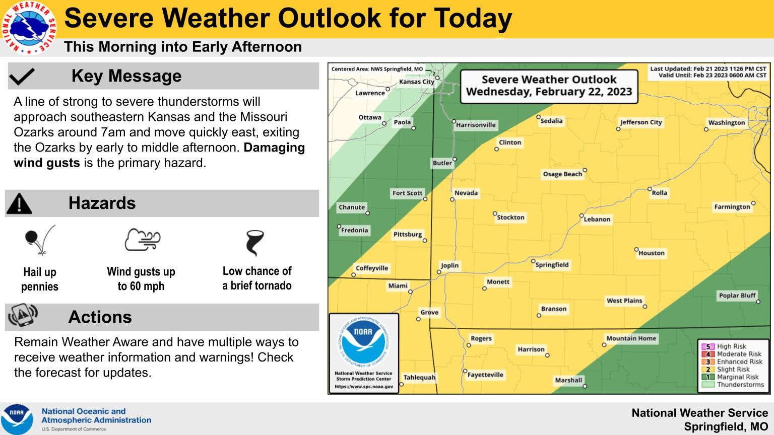
A storm system will make its way through the Lakes Region this morning bringing the potential of strong to severe thunderstorms.
National Weather Service Forecasters says the strongest storms will hit the region mid to late morning into the early afternoon hours with 60 MPH or higher winds possible during the storms. Penny to quarter size hail is a possibility as well.
Skies will clear late in the day followed by the second part of the front that will move through Thursday dropping temperatures during the day. Strong wind gusts remain possible through Friday.
 CMN Radiothon Year 3 Results in Around $82,000 in Donations
 Ozark Man Hurt in Taney County Crash
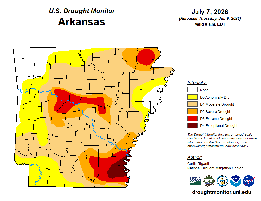 Drought Area Continues to Dwindle
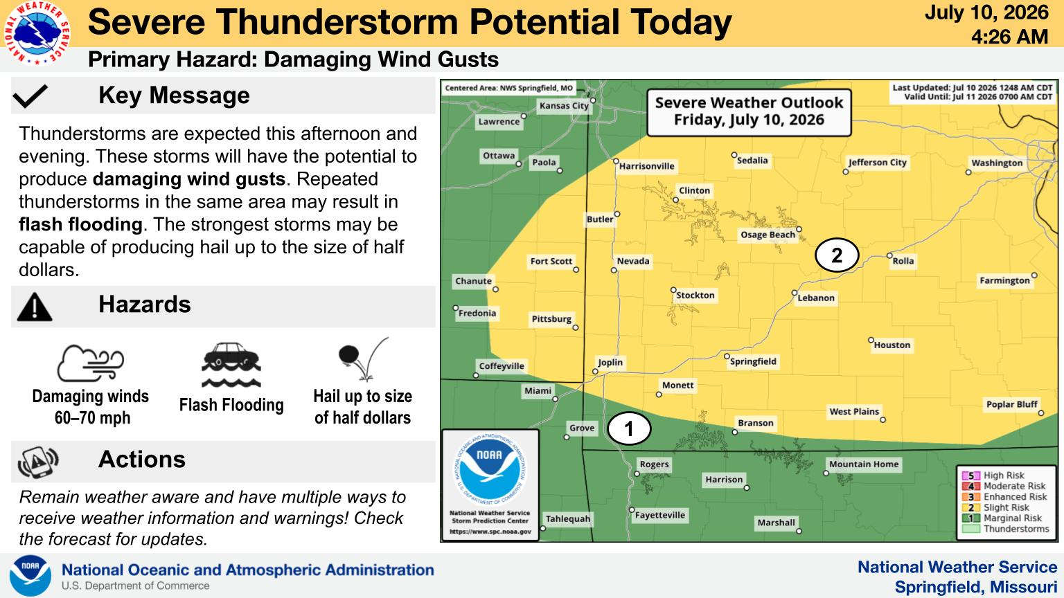 When Will the Next Chance of Rain Arrive?