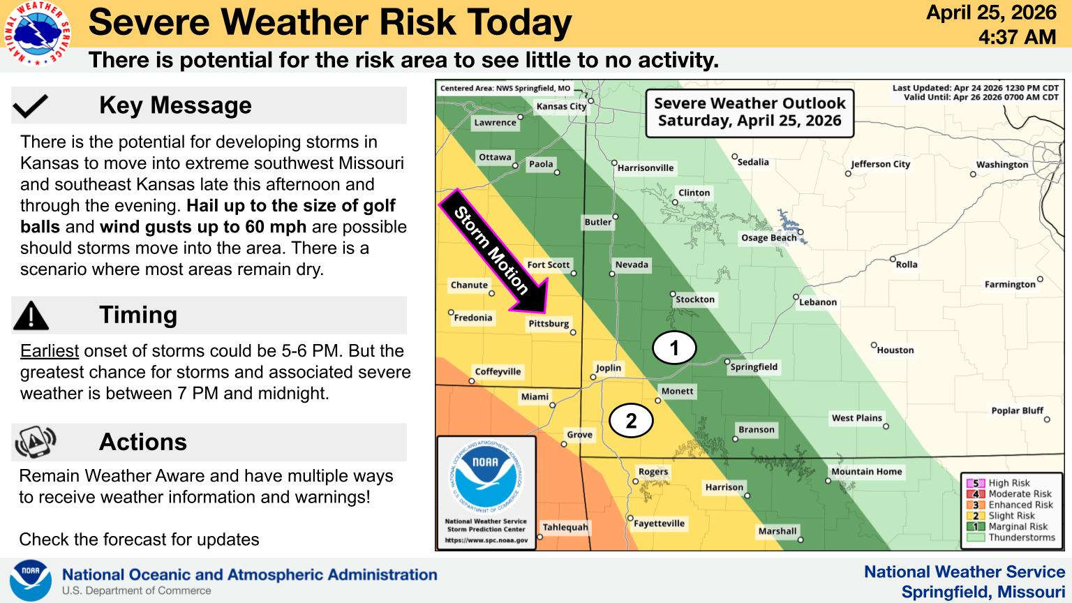
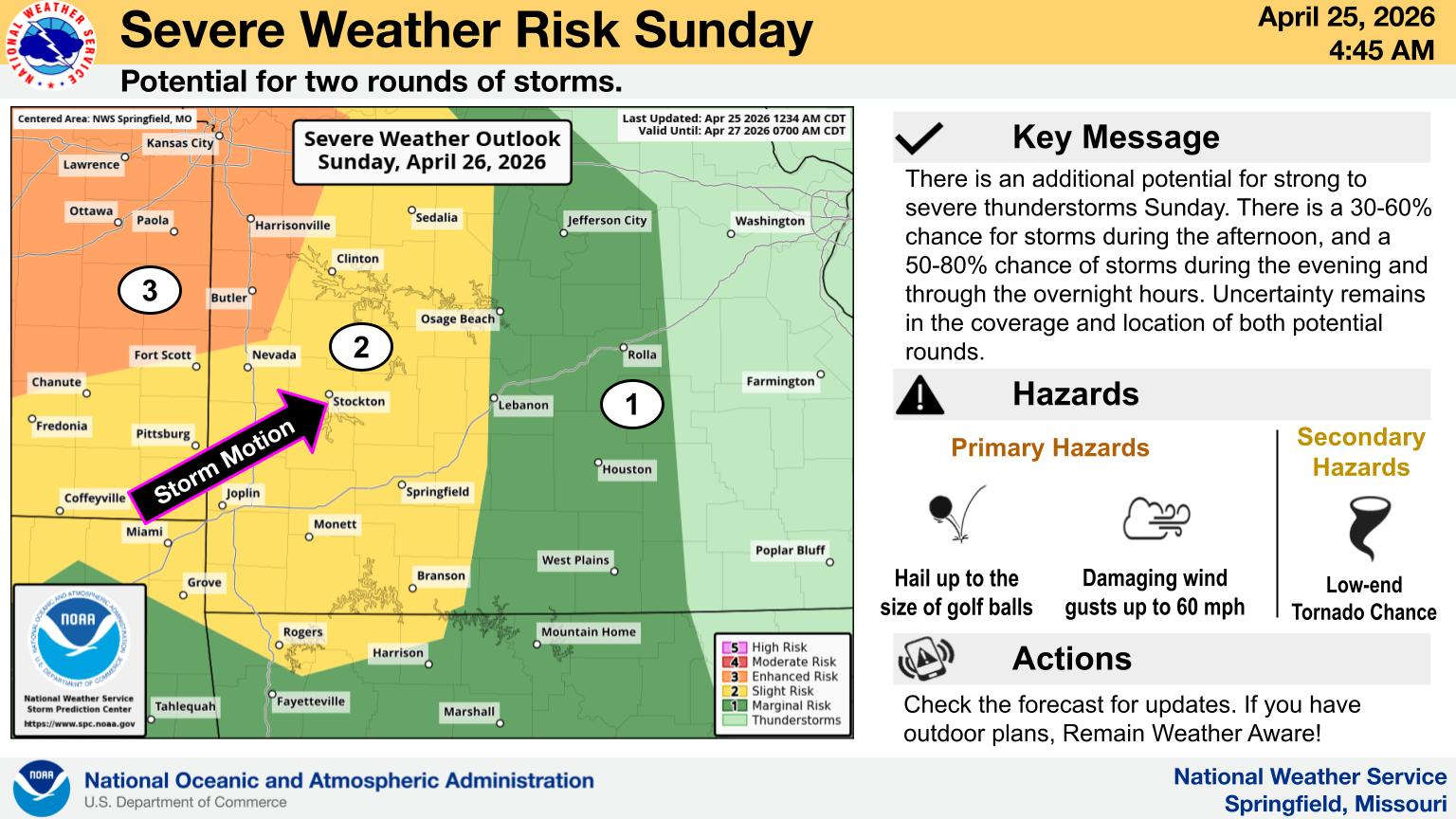
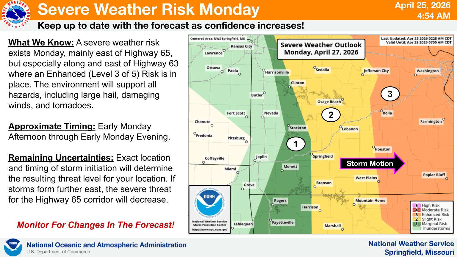
Several chances of showers and thunderstorms capable of producing severe weather are possible in the Lakes Region.
After a foggy start to Saturday morning, precipitation is not expected in the Lakes Region until Saturday night into Sunday morning. National Weather Service forecasters say storms are expected to be scattered with no greater than a 50% chance of rain through Monday, but storms that do develop have the potential for hail to the size of golf balls and damaging wind gusts of 60 to 70 mph if storms develop or move into the area. Localized flooding will be possible if storms can move across the same locations.
A Marginal to Slight Risk of Severe weather is expected over the next three days.
 CMN Radiothon Year 3 Results in Around $82,000 in Donations
 CMN Radiothon Day 2
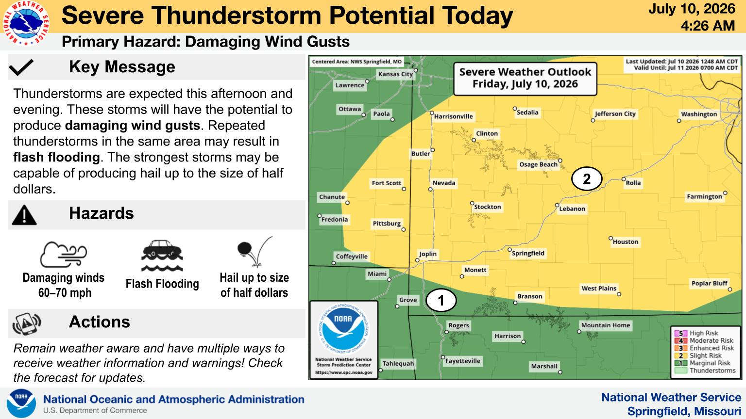 When Will the Next Chance of Rain Arrive?
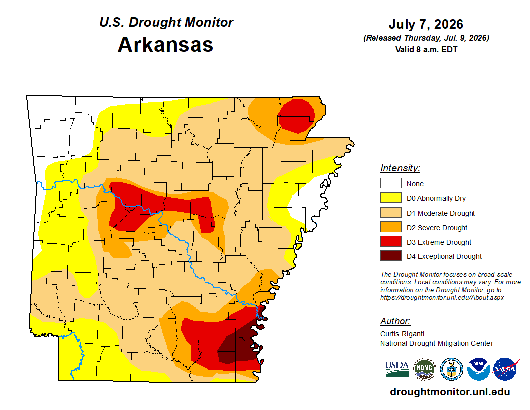 Drought Area Continues to Dwindle
 Stone County Crash Injures Three People