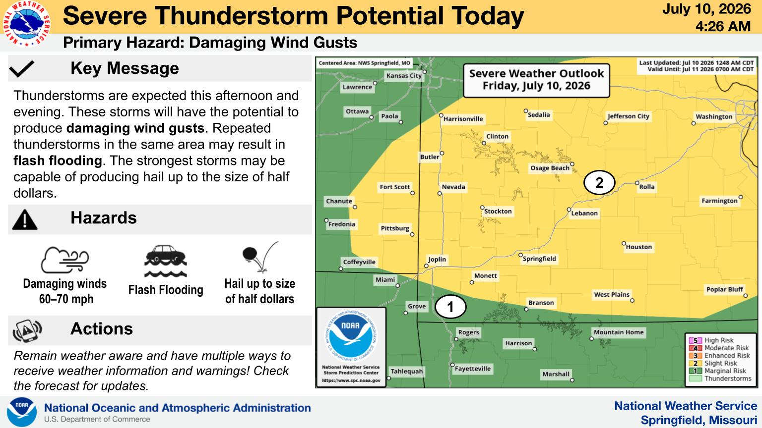
A frontal system will bring a chance of thunderstorms this afternoon followed by colder temperatures for the weekend.
According to projections from the National Weather Service, the storms should move through the Lakes Region mid to late afternoon. While there is just a Marginal chance that some storms could be severe, large hail and damaging wind gusts are the primary threats with the storms.
Temperatures will drop over the next couple of days until Saturday night, when temperatures could reach the freezing mark bringing a chance of frost to the Lakes Region.
High temperatures will be in the 60’s with a chance of rain in the forecast again for early next week.
 CMN Radiothon Year 3 Results in Around $82,000 in Donations
 CMN Radiothon Day 2
 When Will the Next Chance of Rain Arrive?
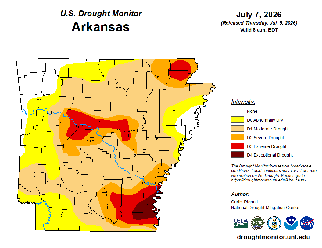 Drought Area Continues to Dwindle
 Stone County Crash Injures Three People