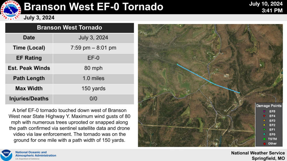
A tornado was part of a storm that moved through Stone County on July 3rd.
According to a survey report by the National Weather Service office in Springfield, an EF-0 Tornado came down in an area west of Branson West near Y Highway. According to information gathered from the ground plus by satellite and drone footage, the tornado was on the ground for about a mile with maximum wind speeds of 80 MPH and was 150 yards in diameter. Several trees were uprooted or snapped along the path of the tornado.
The survey report also states that the damage in the Cape Fair area including the marina was caused by a rear-flank downward surge that caused more widespread wind damage in that area including at the marina where the dock was damaged, and several boats were submerged.
 CMN Radiothon Year 3 Results in Around $82,000 in Donations
 CMN Radiothon Day 2
 When Will the Next Chance of Rain Arrive?
 Drought Area Continues to Dwindle
 Stone County Crash Injures Three People