The weekend will see an end to the days of rain and thunderstorms, a quick blast of winter, and a slow return to spring conditions.
The National Weather Service says the final round of showers and thunderstorms will move through today. While little to any severe weather is expected, more heavy rain and flooding is possible. Flood Warnings remain in place for Branson/Hollister and areas north and west into the afternoon.
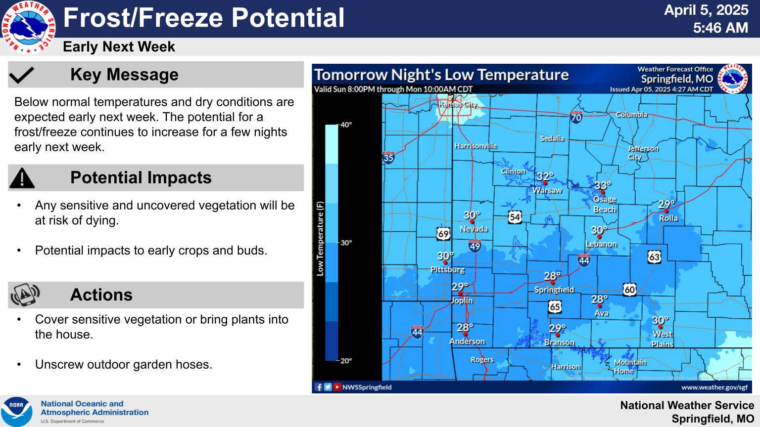
Conditions will have a winter feel this weekend with highs both today and Sunday only in the 40s and the low tonight in the mid 30s. As precipitation ends on Sunday, there is even a slight chance of some light snow though no accumulation is expected.
Frost is possible for both early Monday and Tuesday mornings with lows at or just below 30 on Monday then around freezing on Tuesday. Highs will be in the 60s early in the week and back into the 70s by Wednesday. After rain moves out on Sunday, no precipitation is in the forecast for the coming week.
 CMN Radiothon Year 3 Results in Around $82,000 in Donations
 Ozark Man Hurt in Taney County Crash
 Drought Area Continues to Dwindle
 When Will the Next Chance of Rain Arrive?