
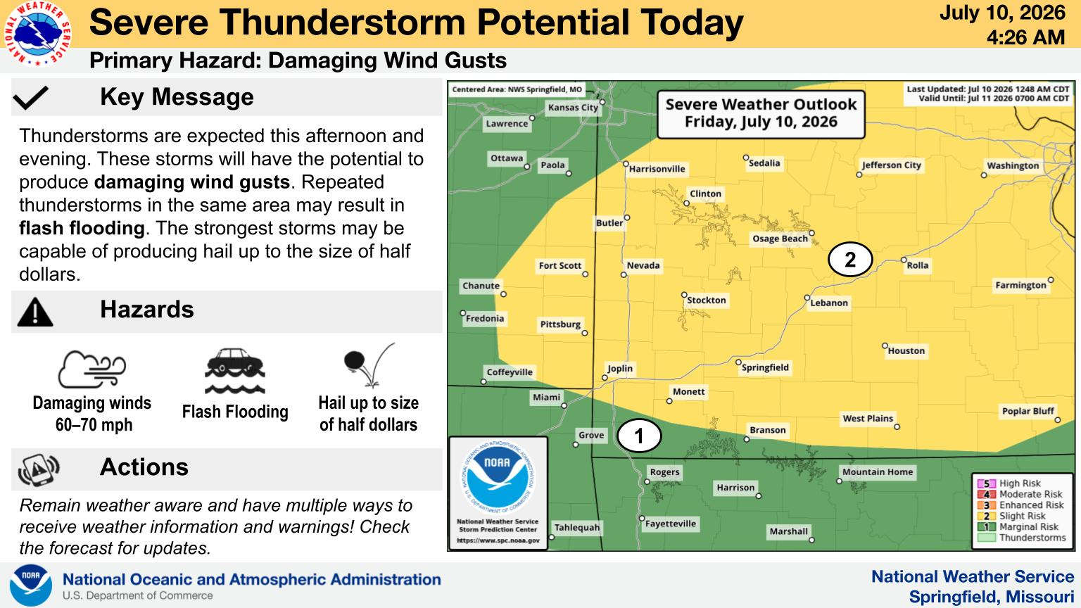
The Lakes Region will see rainy, windy conditions over the next 24 hours.
The National Weather Service has issued a Wind Advisory for the entire region beginning this evening and going through Monday with gusts possible from 40-50 MPH.
In the meantime, rain will begin to spread through the area as some areas getting possible 2-3 inches of rain. Showers are expected to begin early Monday morning and continue through the day. Forecasters the area of highest rainfall totals include areas 50 miles either side of a line from near Rolla in central Missouri through much of the lakes region into Arkansas around the Harrison area. The rainfall is expected to impact all of Lake Taneycomo, most of Bull Shoals Lake, and eastern sections of Table Rock Lake. Some localized flooding is possible.
Another blast of cooler air is expected following the low temperatures expected at or below freezing Monday through Wednesday evenings.
 CMN Radiothon Year 3 Results in Around $82,000 in Donations
 CMN Radiothon Day 2
 When Will the Next Chance of Rain Arrive?
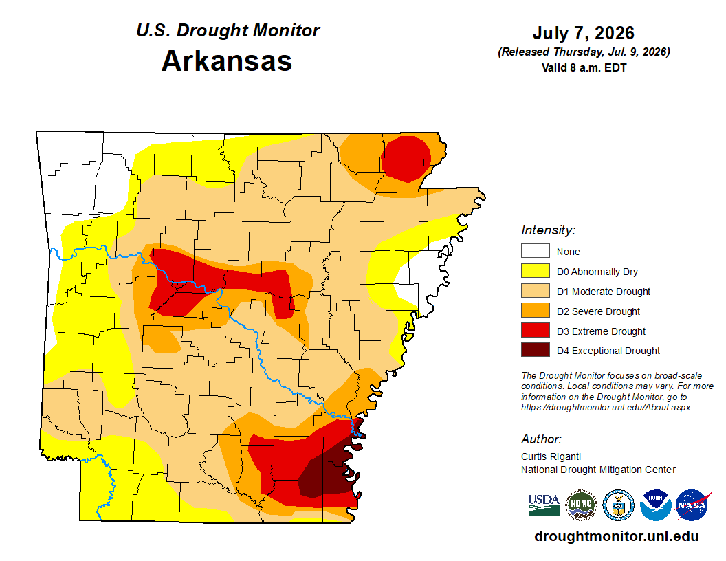 Drought Area Continues to Dwindle
 Stone County Crash Injures Three People