


A cold front heading to the Ozarks will offer a chance of some minor snow accumulations and significantly lower temperatures.
National Weather Service forecasters say snow flurries will be the most likely precipitation with accumulations likely north of the Lakes Region tonight into Thursday morning. Meantime temperatures, which has just rebounded after the weekend cold front, will again drop and strong north winds could see wind chill readings dip below zero.
High's Thursday will only reach the upper 20's with low temperatures in the teens.
Another storm system will move through the Lakes Region Saturday. Some area may see some freezing rain early but most areas will see just rain as temperatures will be above freezing most of the day.


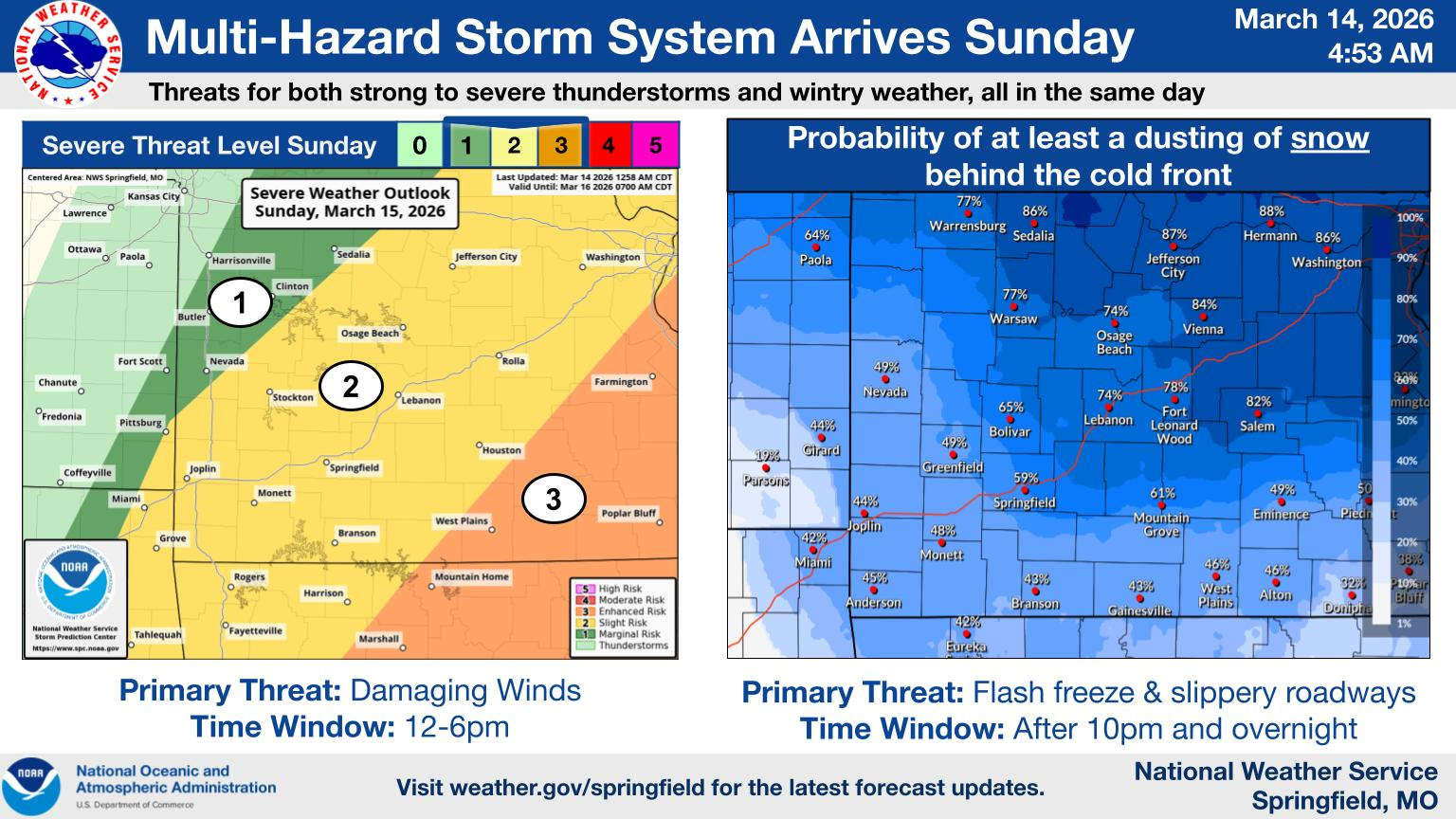 A Full Range of Weather This Weekend in the Ozarks
 Spring Fling Event Coming to Downtown Branson
 Silver Dollar City Season 66 Opens Today
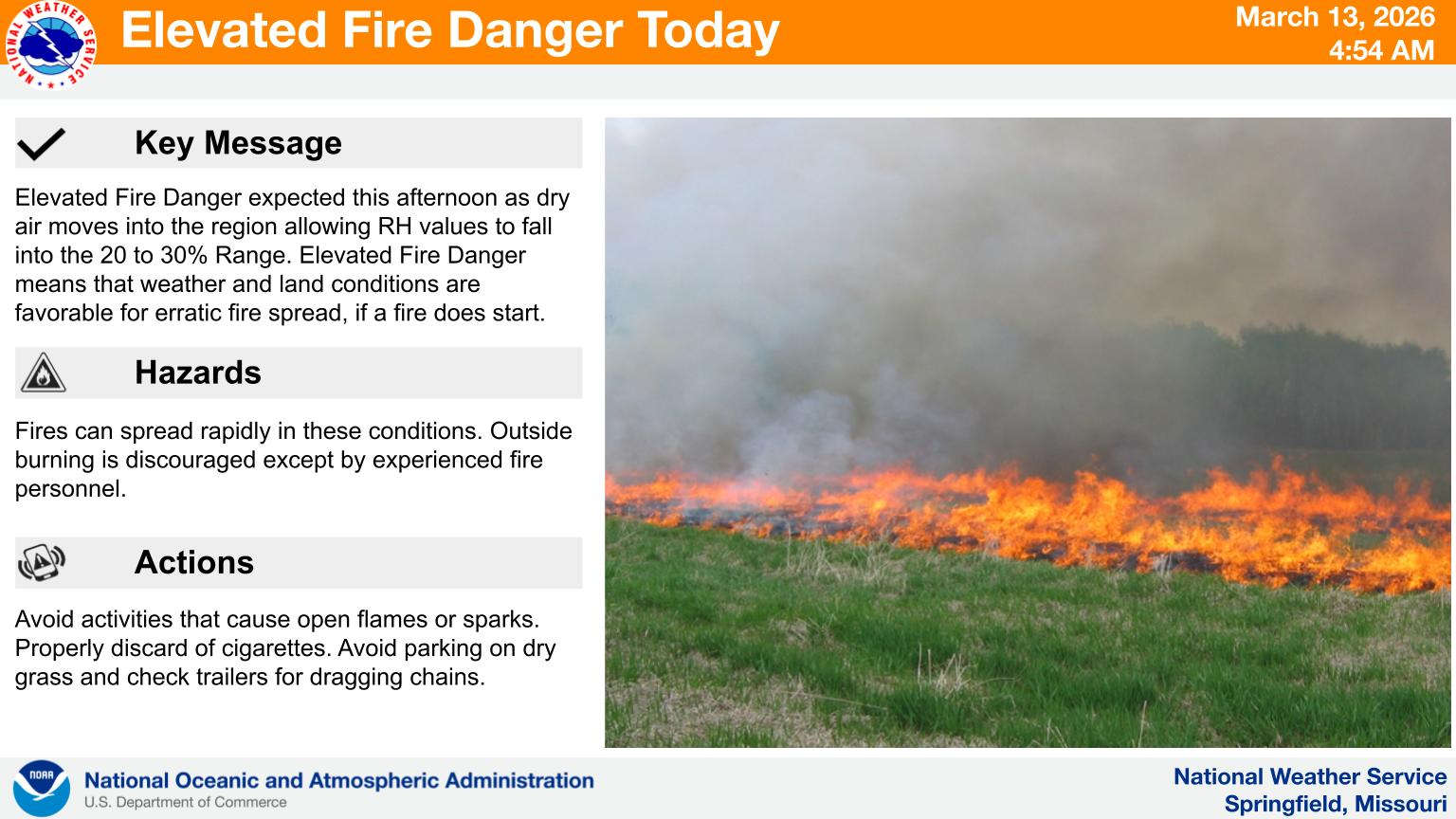 Fire Danger Today, Extreme Temperatures Expected over Next Week
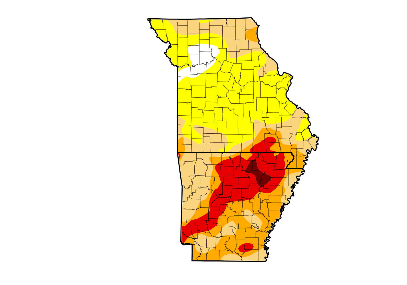 Rain Reduces Drought for Parts of the Lakes Region