


A couple of rounds of mostly light snow are in the forecast for this week as well as much colder weather by the Christmas Weekend.
National Weather Service forecasters say the first round of snow could happen overnight tonight into Monday. The precipitation will begin as light rain with temperatures expected to stay at or just below freezing. Very little if any accumulations are expected with most of the impacts occurring in the western parts of the Arkansas and Missouri Lakes Region.
Much colder air is in the forecast for later this week a a cold front will push through the area Wednesday night into Thursday bringing in another chance of snow. Any snowfall should be out by Thursday afternoon but much colder temperatures will filter into the region with Thursday's low expected to be below zero and Friday's high only in the teens. Temperatures will begin to rebound on Christmas Eve Saturday but still be below normal for the Christmas Weekend.


 Spring Fling Event Coming to Downtown Branson
 Silver Dollar City Season 66 Opens Today
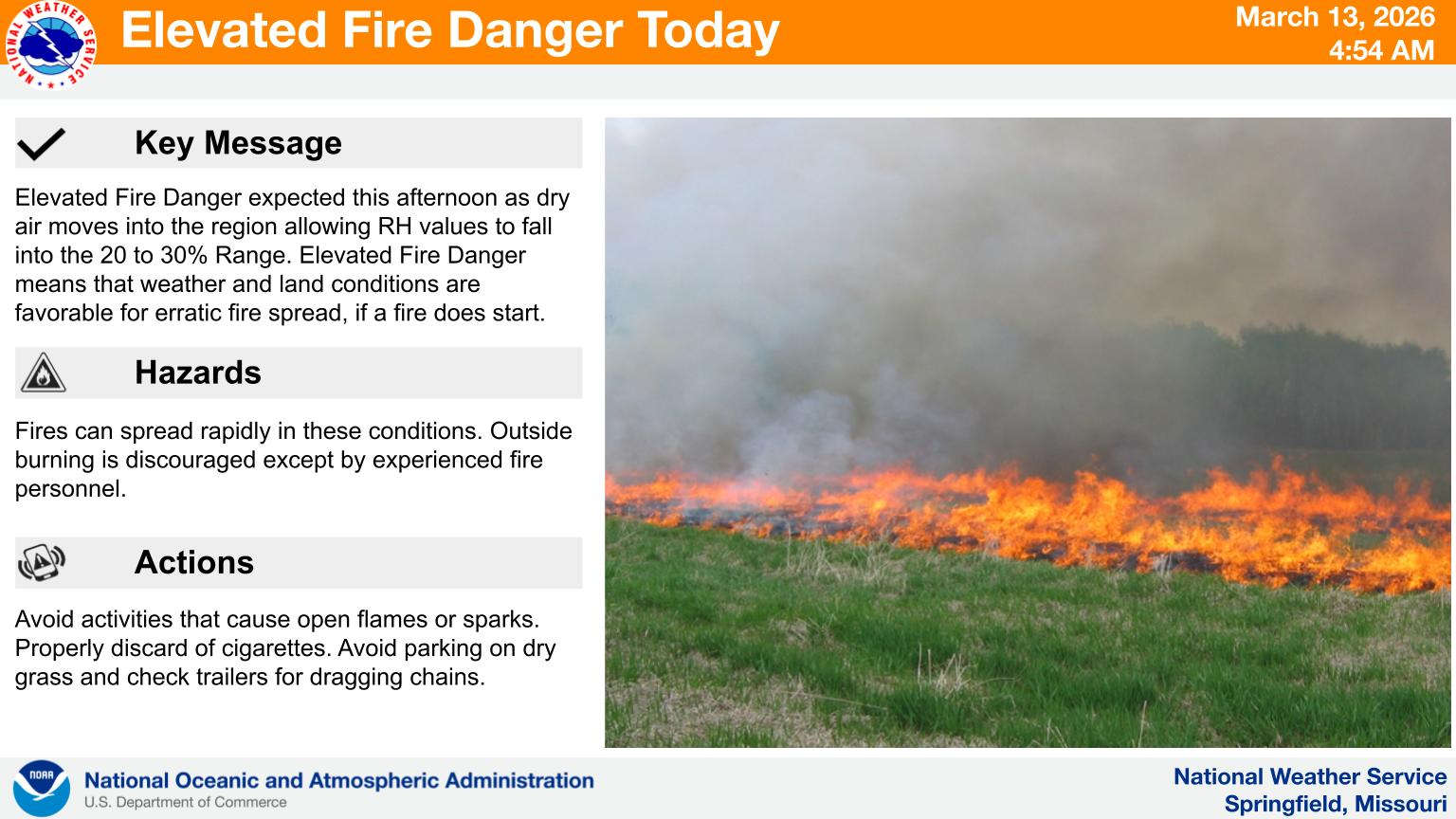 Fire Danger Today, Extreme Temperatures Expected over Next Week
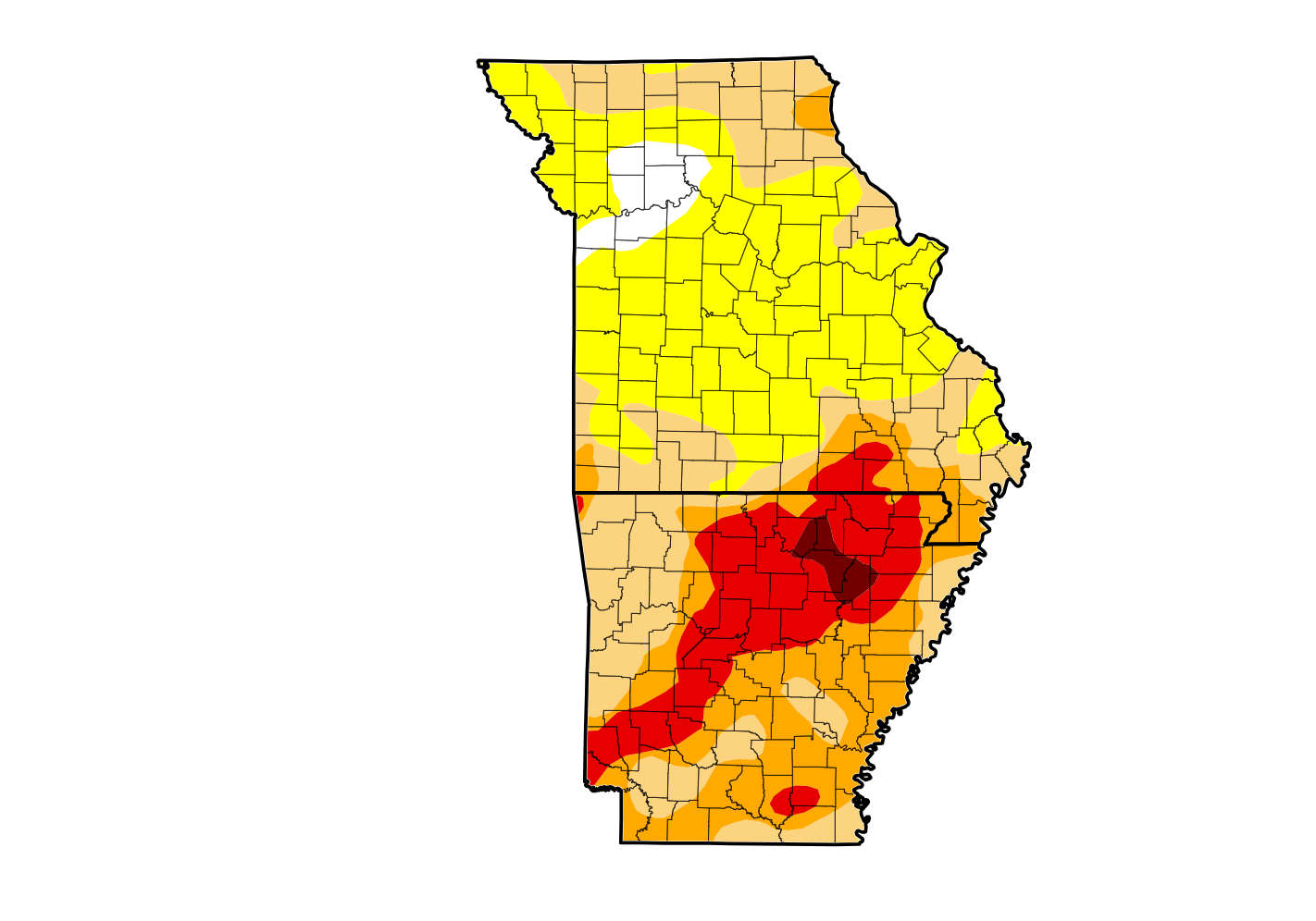 Rain Reduces Drought for Parts of the Lakes Region
 Woman Sentenced in 2025 Kimberling City Apartment Fire