

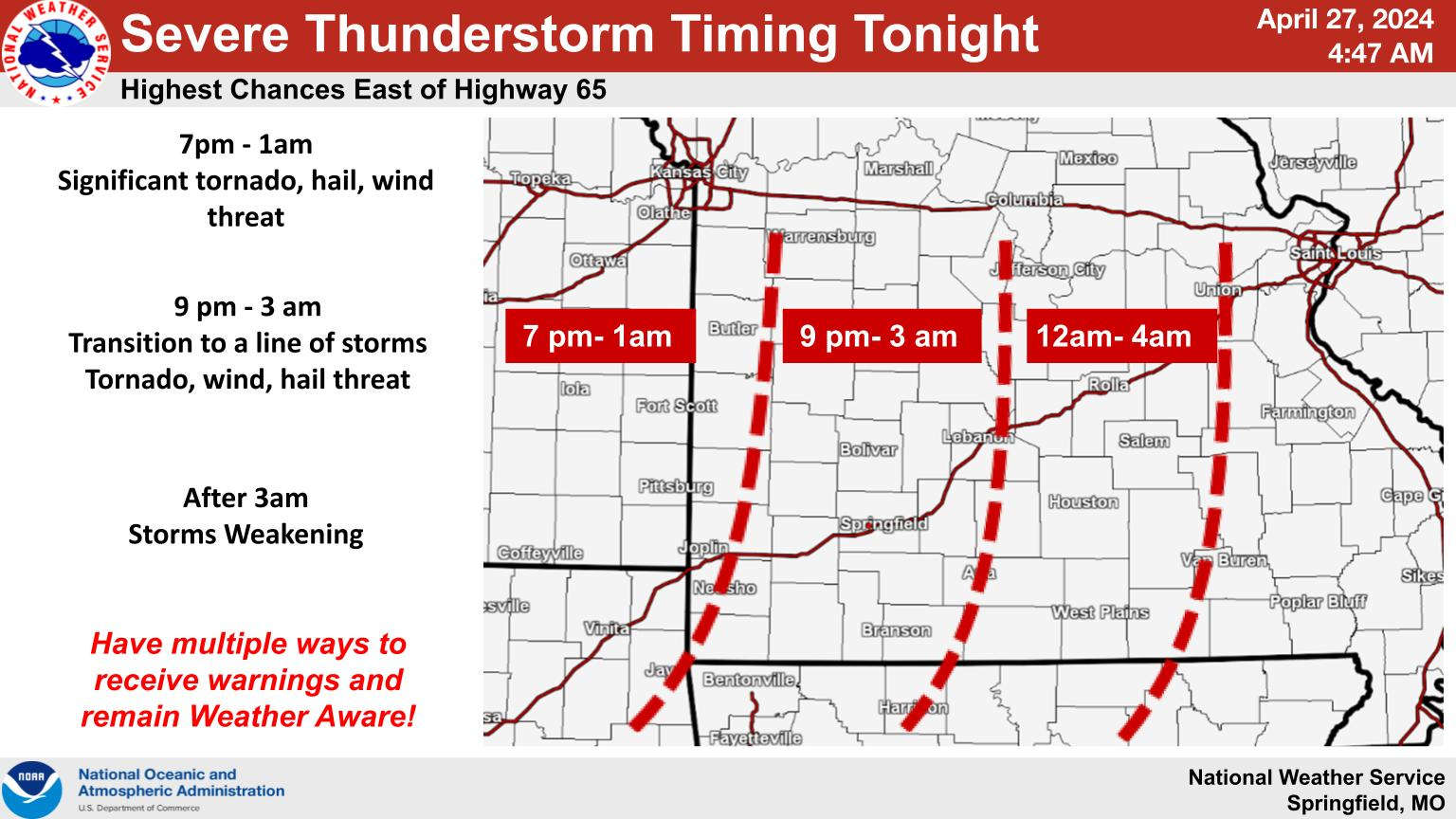
Many in the Lakes Region will see a break in the rain today but tonight into Sunday sees the chance for storms redeveloping.
The latest information from the National Weather Service indicates most areas will see a break from the rain for parts of the day. Some areas may see a few peeks of sun but for the most part, skies will stay cloudy. Showers and thunderstorms will redevelop later this afternoon into the evening with a chance of severe weather as the storms move through. Forecasters expect the highest risk of severe storms in the Lakes Region will occur from around 9:00 this evening through 3:00 Sunday morning. High winds and hail are the main threats with the storms though isolated tornados are possible as well. Forecasters expect the storms to weaken as the evening goes which should reduce the severe threat as they move into the eastern part of the Lakes Region.
Heavy rain is also possible with this system with two to three inches of rain possible increasing the risk for flooding, especially in areas that already have received significant rainfall.
Another round of severe storms could develop Sunday afternoon as another wave of storms move through.


 Spring Fling Event Coming to Downtown Branson
 Silver Dollar City Season 66 Opens Today
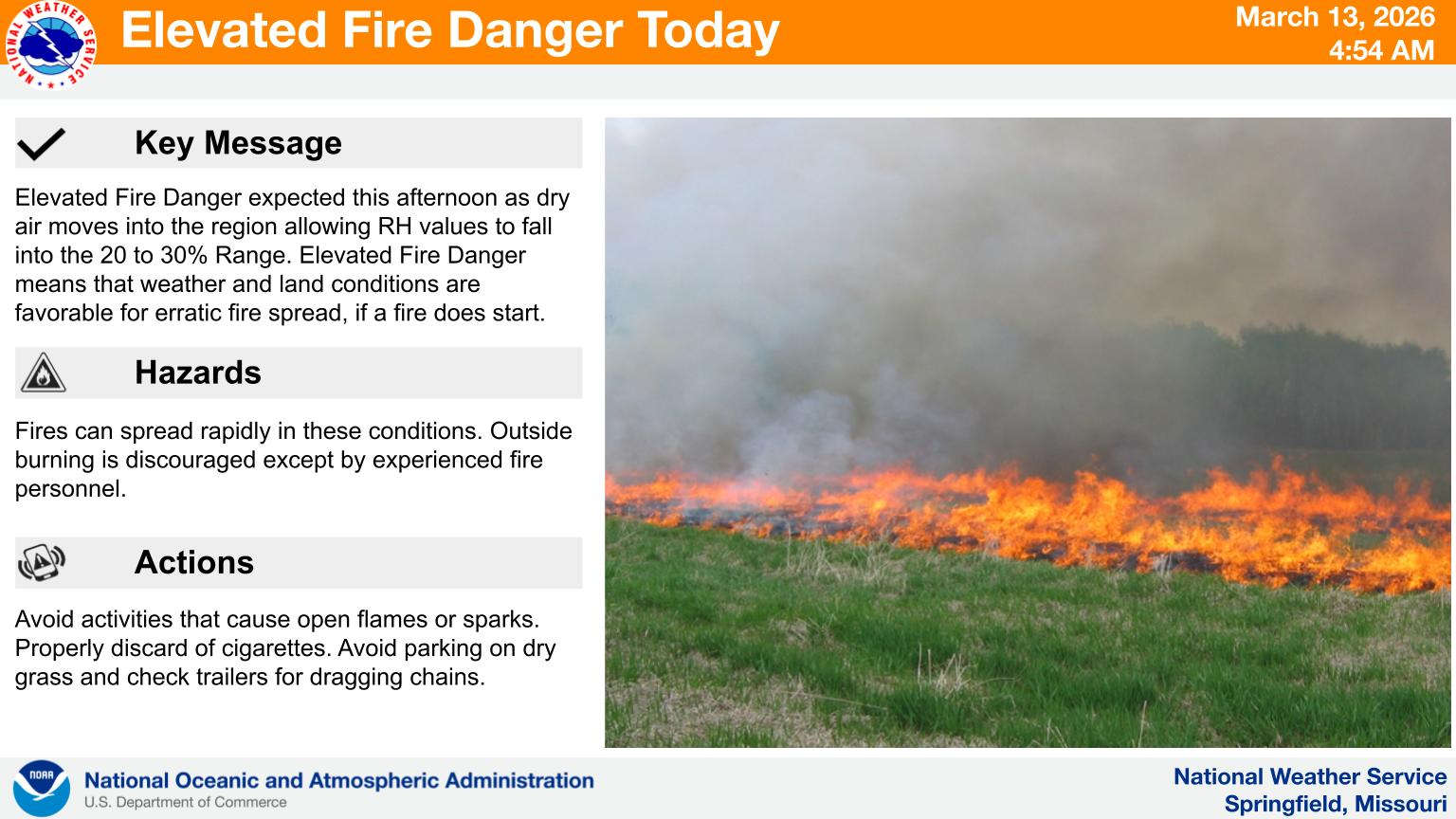 Fire Danger Today, Extreme Temperatures Expected over Next Week
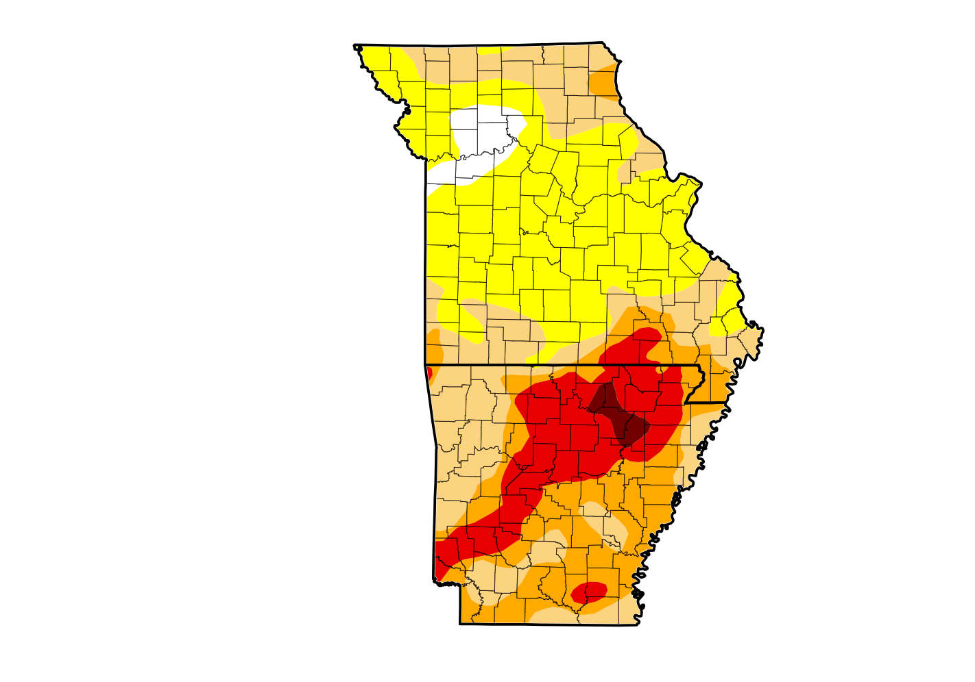 Rain Reduces Drought for Parts of the Lakes Region
 Woman Sentenced in 2025 Kimberling City Apartment Fire