
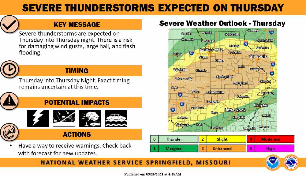
Much of Northwest Arkansas and Southwest Missouri could see a round of Severe Weather on Thursday.
Forecasters for the National Weather Service say that Thunderstorm development will build on Thursday afternoon into the evening with Damaging Winds, Large Hail, and Flash Flooding the biggest risks.
Much of the region will see a break in the rain today with just chances of scattered showers before Thursday’s Severe Potential. Forecasters say much of the upcoming Memorial Day Weekend will be dry with a chance of some showers redeveloping on Monday.


 Branson Fire Chief Ted Martin Celebrated on Last Day on the Job
 Firefighters Rescue Driver of Vehicle That Went Down an Embankment
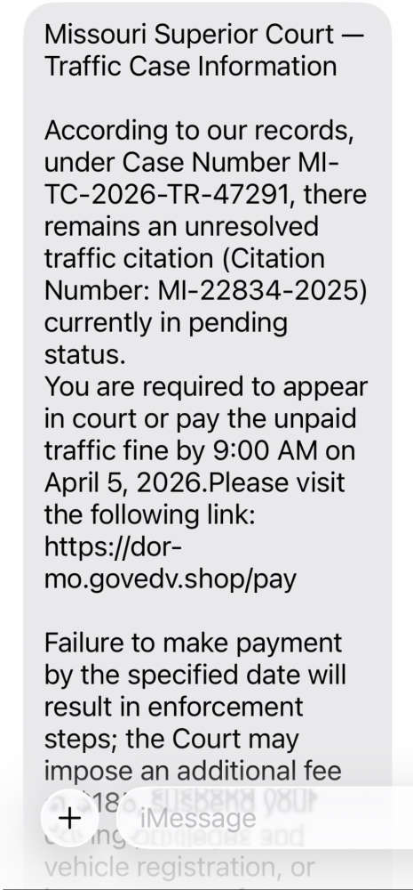 SCAM Warning from Missouri State Highway Patrol
 Saturday Crash Blocks Traffic in Kimberling City
 Rain Rolls Through the Region, Cool Easter Morning Ahead