

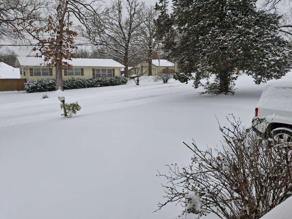
As the snow begins to move out of the Ozarks, cold air will continue to tighten its grip.
A final wave of snow will move through the Lakes Region this morning before moving out of the area by mid-afternoon. Current snowfall totals reported by various sources are around six to eight inches including a report to the National Weather Service from Stone County Emergency Management of just under six inches in the Kimberling City area. Branson was one of the areas in the Lakes Region that saw sleet fall later Saturday afternoon into early evening that preceded the second round of snow.
Another inch or two of snow is possible before it ends this afternoon. The Winter Storm Warnings in effect for the Lakes Region will end this afternoon.
All roads are snow covered in the region with state, county, and city crews continuing work on roads.
While the snow ends, cold temperatures continue. The Missouri Lakes Region joins Arkansas in going under an Extreme Cold Warning through Monday morning as Wind Chills could dip down to 20 below zero overnight with actual temperatures to also fall below zero.
The NWS Forecast calls for temperatures to stay cold with highs possible getting just above freezing by midweek but going back below freezing with another front late in the week.
Check our websites for the latest business and church closings in the region.


 Silver Dollar City Season 66 Opens Today
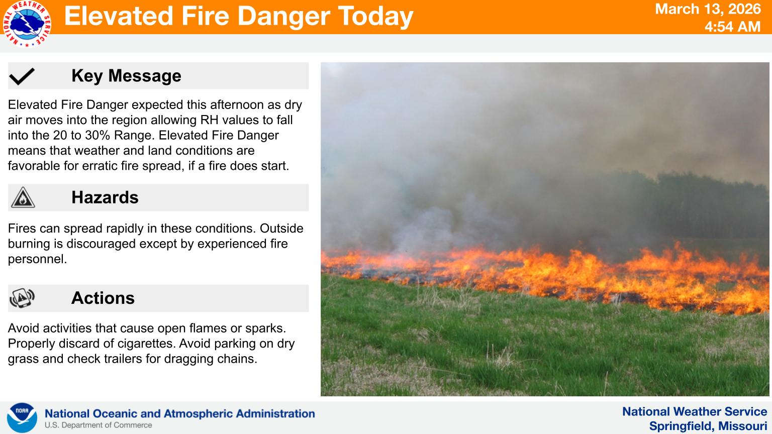 Fire Danger Today, Extreme Temperatures Expected over Next Week
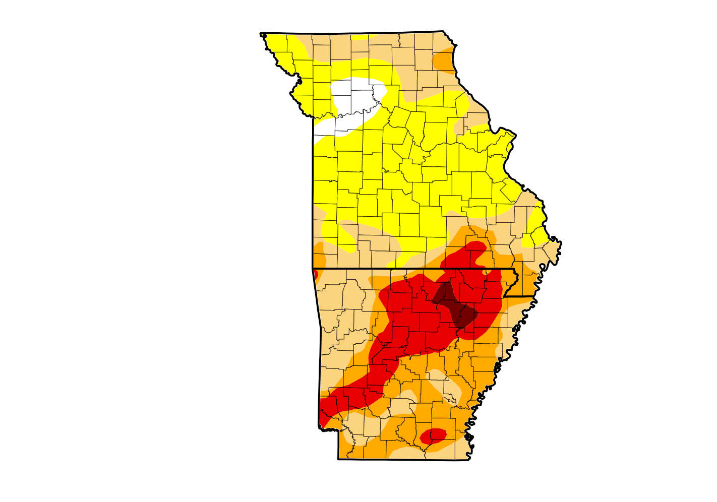 Rain Reduces Drought for Parts of the Lakes Region
 Woman Sentenced in 2025 Kimberling City Apartment Fire