

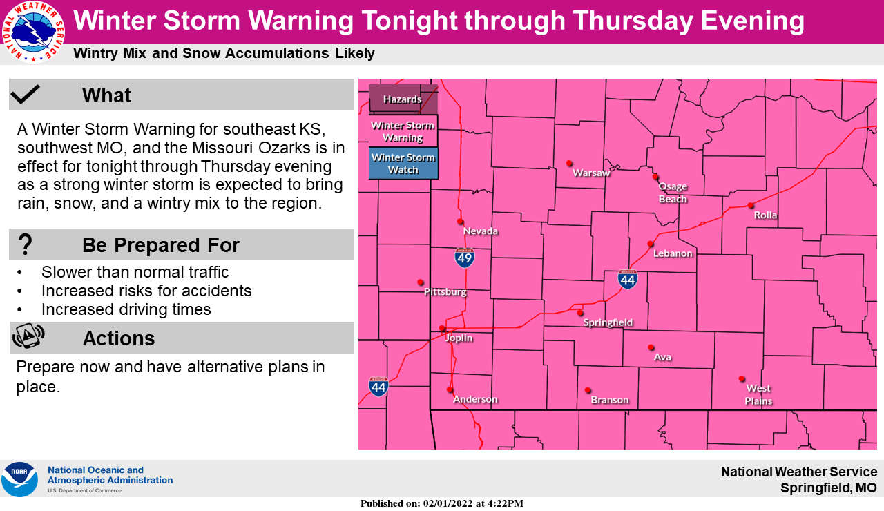
As a storm system approaches the Lakes Region, forecasters predict the impact will be significant.
After Winter Storm Watches had been issued for the storm as early as Monday, the National Weather Service Offices in the region have been upgrading the advisories to Winter Storm Warnings which will be in effect all day Wednesday and Thursday.
Precipitation will begin transitioning from rain early Wednesday morning into a mixture of freezing rain and sleet until it finally becomes all snow late Wednesday. A tenth to a quarter inch of ice accumulations are possible with potential snow accumulations up to eight inches possible. Gusty winds could affect visibility on Wednesday.
Very cold temperatures will also accompany the frontal system with temperatures below freezing the rest of the week and wind chills around zero possible both Wednesday and Thursday.
Many school in the region have already cancelled classes for Wednesday and some for Thursday as well. The list will be updated throughout the evening on this website's cancellation page.


 Silver Dollar City Season 66 Opens Today
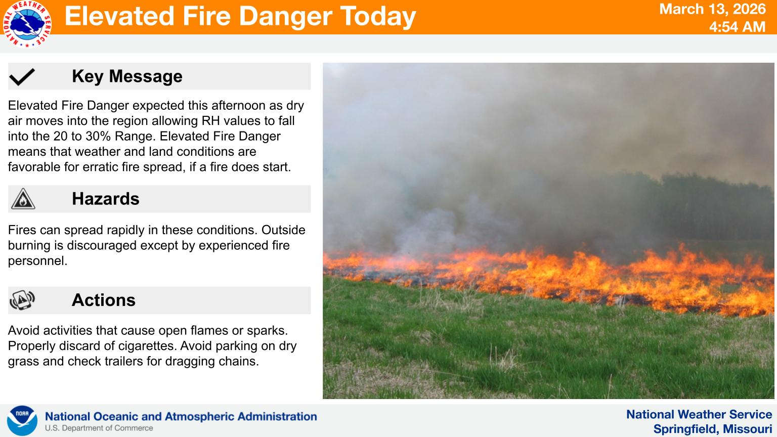 Fire Danger Today, Extreme Temperatures Expected over Next Week
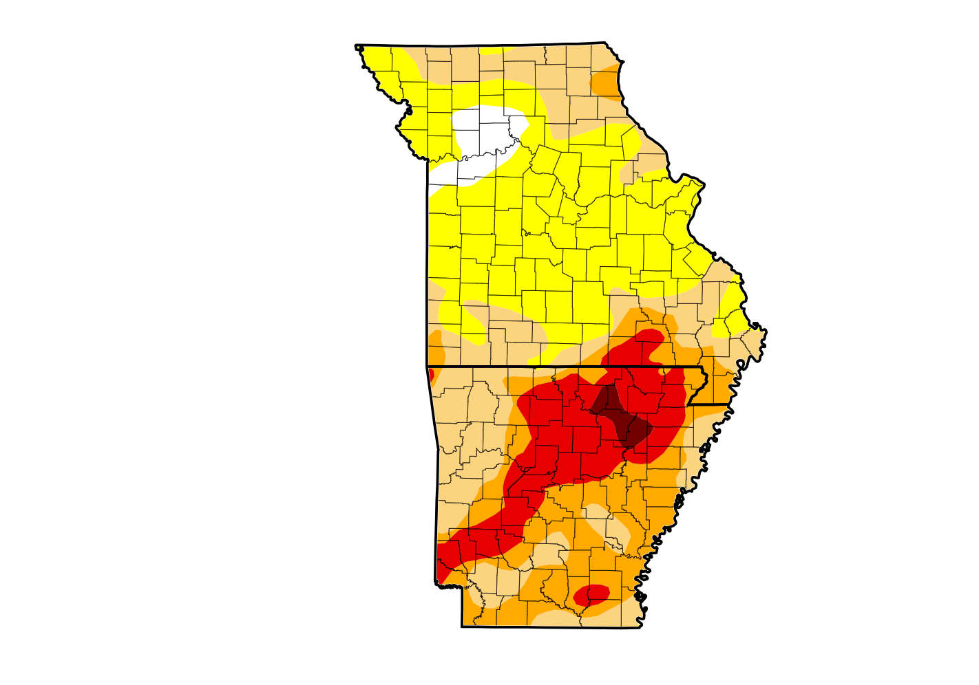 Rain Reduces Drought for Parts of the Lakes Region
 Woman Sentenced in 2025 Kimberling City Apartment Fire